

Cosdon Hill [South Tawton Common]
Good walks are even better shared.
SX6391 : Cosdon Hill cairn
Guy Wareham Photo source
Overview
Cosdon Hill [South Tawton Common]
Located in the heart of Dartmoor National Park, Cosdon Hill stands proudly at an elevation of 462 meters. As a Marilyn peak, it possesses a certain charm that beckons hikers from afar. The rocky granite underfoot tells tales of ancient geological processes, while the expansive views from the summit are a photographer's dream.
Geology
Cosdon Hill’s granite origins are well worth a mention. Formed over 280 million years ago, this robust rock provides the backbone of Dartmoor's rugged landscape. If you're a geology buff, keep an eye out for the unique weathering patterns that add character to the already bewitching scenery.
Routes
The most popular route is the South Tawton Common Circular, a moderate trek of about 8 km that meanders through verdant landscapes and open moors. Alternatively, the Cosdon Hill from Fingle Bridge route offers a challenge for seasoned hikers, stretching over 12 km with a variety of terrains that will push your limits (in a good way!).
Summit Features
At the summit, you'll encounter a classic cairn and a sturdy trig point that stands like a sentinel over the moor. Be sure to snap a photo here, as one does when they reach the pinnacle of their endeavours.
Terrain
Prepare yourself for a mix of grassy slopes, rocky outcrops, and the occasionally boggy patch. A sturdy pair of boots is recommended for navigating the varying terrain. You'll soon discover that while the views are rewarding, the terrain can be a little unpredictable.
Views
The views from Cosdon Hill are nothing short of spectacular. On a clear day, gaze across the stunning landscape of Dartmoor, with highlights including Yes Tor and High Willhays. Visiting in spring or autumn offers the best opportunities for those Instagram-worthy shots, while misty mornings may lure photographers seeking a mystical vibe.
Hazards
While enjoying your hike, be mindful of weather changes that Dartmoor is notorious for. Sudden fog can obscure views and potential slips can arise from the uneven ground. Proceed with caution and a fair amount of common sense!
Access
The nearest parking is conveniently located at South Tawton Common, providing easy access to the trailhead. Public transport options are available from Exeter, with local buses that can drop you close by. The local village of South Tawton is not just a quaint stop but a community that welcomes weary hikers.
Facilities
After a hearty hike, why not treat yourself? The South Tawton Inn offers a delightful menu and is perfect for enjoying a warm meal or cooling off with your beverage of choice post-hike.
History
The name 'Cosdon' likely refers to 'Cows' Hill', reflecting the pastoral traditions of the area. Historically, Cosdon Hill has provided not just a beautiful backdrop but pathways and meeting points for those traversing the moors.
In conclusion, Cosdon Hill [South Tawton Common] is a delightful destination for both novice and seasoned hikers, presenting stunning views, diverse routes, and a touch of historical charm. So lace up your boots, pack a picnic, and head out to explore this captivating corner of Dartmoor!
Explore routes near Cosdon Hill [South Tawton Common]
Walks starting near this hill. Open a route to check its map, distance and full itinerary.
Castle Drogo and Fingle Bridge: Teign Gorge woodland circuit
View route
Moretonhampstead to Lustleigh: Wray Valley woodland railway trail
View route
Granite Way: Lydford village to Okehampton Station
View route
Cookworthy Woods Level 2 walk
View route
Route planning notes
These notes describe possible approaches. Check a route's map and access information when planning your walk.
South Tawton Common Circular
A scenic circular route starting at South Tawton with a mixture of track and open moorland.
Cosdon Hill from Fingle Bridge
A more challenging route taking you from Fingle Bridge through varied landscapes, including wooded areas and open moor.
Make a day of it, together
Find someone to share the walk with, or organise a day out along a route you like.
Photo Gallery
View all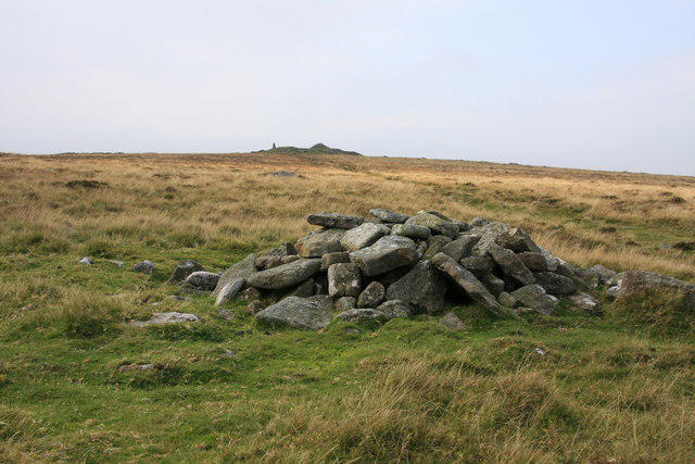 Photo could not load
SX6391 : Cosdon Hill cairn
Guy Wareham
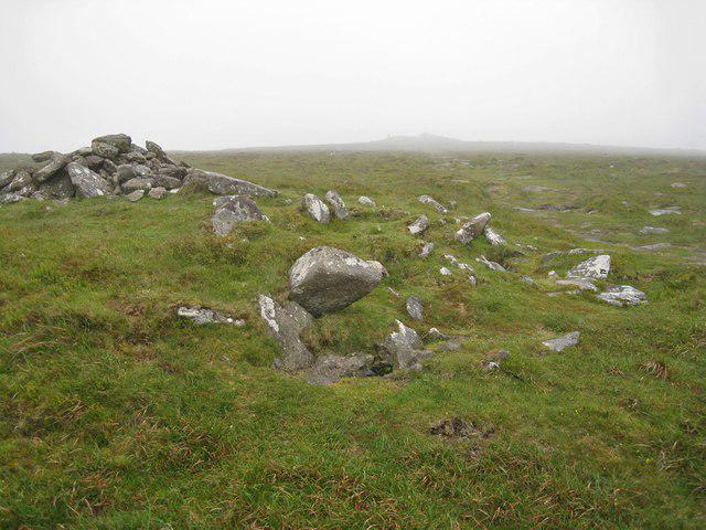 Photo could not load
SX6391 : Ancient cairns on Cosdon Hill
Richard Dorrell
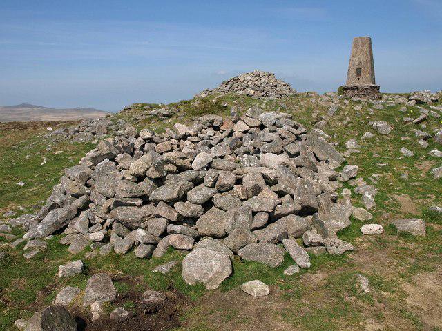 Photo could not load
SX6391 : Shelter at Cosdon Beacon
Derek Harper
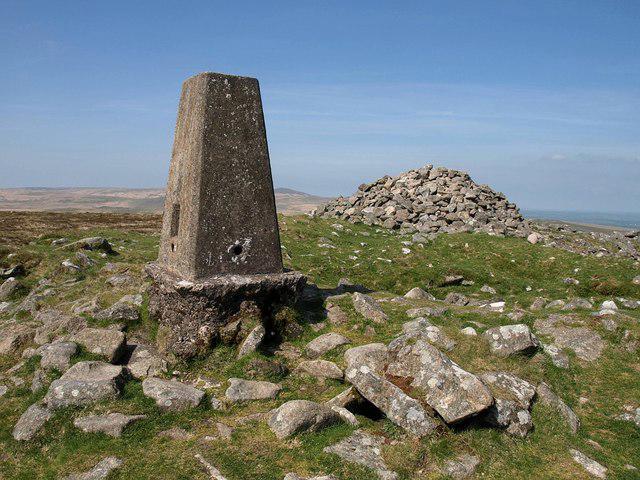 Photo could not load
SX6391 : Cosdon Beacon
Derek Harper
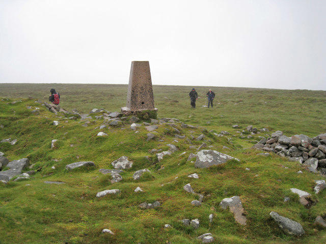 Photo could not load
SX6391 : Cosdon Hill, summit trig point
Richard Dorrell
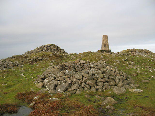 Photo could not load
SX6391 : Cosdon Beacon
Chris Andrews
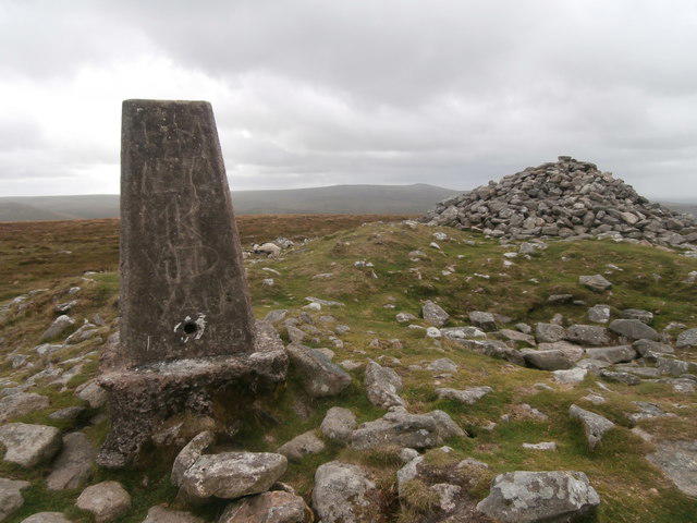 Photo could not load
SX6391 : Trig point and cairn, Cosdon Beacon, Dartmoor
John Lord
Hill facts and local notes
Classifications
Elevation
550m
1,806 ft
Prominence
80m
Coordinates
50.7071, -3.9329
SX636915
OS Map
191
Explorer: OL28N 113
At the Summit
The summit features a prominent cairn and a trig point, ideal for those wanting to snap a triumphant selfie.
Terrain & Geology
Cosdon Hill is primarily composed of granite, characteristic of the Dartmoor area. This resilient rock formed over 280 million years ago and contributes to the rugged, unique terrain of the region.
Views & Scenery
From the summit, you can enjoy sweeping views of Dartmoor's rolling hills, with landmarks such as Yes Tor and High Willhays in the distance.
History & Heritage
Name Origin
The name 'Cosdon' is thought to derive from the old English words meaning 'Cows' Hill', reflecting the pastoral heritage of the area.
Historical Significance
Cosdon Hill has been a notable landmark for centuries, linking the local culture with historical walking routes and settlements.
Getting There & Facilities
Parking
There is parking available at South Tawton Common, which is a few minutes' walk from the trailhead.
Public Transport
The nearest public transport is available from Exeter, with buses operating to South Tawton.
Nearby Facilities
Nearby facilities include The South Tawton Inn, where you can grab a bite to eat or quench your thirst after an invigorating hike.
Safety Information
Known Hazards
- Potential for sudden weather changes, low visibility in foggy conditions, and tricky, uneven ground leading to slips and trips.
General Safety Tips
- Check weather conditions before setting out
- Carry appropriate clothing and equipment
- Let someone know your planned route
- Take a map, compass, and GPS device
- Carry emergency supplies: food, water, first aid kit, torch
Hills
Some common questions about the hills answered
Are there group walks up Cosdon Hill [South Tawton Common]?
Many walkers use Walkmates to join or organise walks with others. You can check for group walks around Cosdon Hill [South Tawton Common] through the maps
Are there other walkers around Cosdon Hill [South Tawton Common]?
Activity varies by location and time, but Walkmates lets you see whether others have shared walks or shown interest in this area. Find other people through the walking friends search walking friends for Cosdon Hill [South Tawton Common] search or of course create your own walk for Cosdon Hill [South Tawton Common]
Can I organise a walk to Cosdon Hill [South Tawton Common]?
Yes. If there aren’t any walks listed already, you can create a walk and make it available for others to join.
If you're signed up to Walkmates, you can create a walk to Cosdon Hill [South Tawton Common].
How do I find a walk up this hill?
There are often multiple ways to walk this hill, depending on experience and route preference. Walkmates helps you explore walks and routes that others have shared.
Can I suggest a new route up Cosdon Hill [South Tawton Common]?
Yes. You can suggest or create routes to share with others. Walkmates focuses on the social side of walking, so routes are used to help people organise walks and explore areas together, rather than as detailed navigation tools or route libraries.
Other uses really appreciate knowledgeable walkers sharing their routes. Share your favourite route to Cosdon Hill [South Tawton Common] here
The is an error or something incorrect about this hill. How do I let you know?
We always strive to keep the information on Walkmates as accurate as possible. If you find an error, please let us know through the contact form and we'll aim to correct it as quickly as possible
Community Discussion
Comments
Location
![Cosdon Hill [South Tawton Common] location map](https://cdn.walkmates.com/hill-maps/hill-sources/3651/50.70711_-3.93290.png)
Grid reference: SX636915
View on OpenStreetMapOpens a map in a new tab, centred on the hill.
Nearby Hills

High Willhays
622m

Brent Tor
334m

Dunkery Beacon
520m
Brown Willy
420m
Rhossili Down - The Beacon
193m
No comments yet. Be the first.